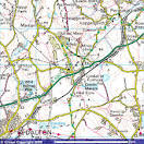
Maps
Maps, our bird’s eye view of the world
Miraculously we soar on high drone-like
O’er the expansive land and sea
Towns and countryside in microcosm
Maps compiled for different purposes
Physical maps to show the hills and valleys
Rivers and lakes, forests and fields
Contour lines trace shape and elevation
Maps political claiming who owns what
The boundaries of the nations
The states therein and cities all identified
Motorways, roads, canals and railways
Maps economic show the sites
Of natural resources, farmland and mines
Factories, mills and fisheries
So much of manufacturing now museum pieces
Maps that let us dive below the surface
Sensing the contours of the ocean floor
Vast trenches and ridges there detected
The conflict of tectonic plates
Maps that are more like diagrams
Zoomed in we confront the details
The London Tube, the airlines’
Skyways to sunshine on exotic shores
Maps of larger scale to take us under streets
Channels and tunnels for our utilities
Power and gas, water and sewerage
And fibre optics for the internet and phones
Maps are not just tied to location
They are also a snapshot in time. There and then
Thus maps can unite geography with history
Depicting the past in time and place
So give thanks for Maps and the work of all cartographers
From the pioneers of the Ordnance Survey
To those who deploy todays drones and satellites
From canvas sheets to GPS the world laid bare
Ken Fisher

Atlas

A special wish that all maps would be preserved *smile*
LikeLike